čísla
1 ¤, 12 ¤, 14 ¤, 22 ¤, 24 ¤, 26 ¤, 36 ¤, 38 ¤, 8 ¤, 83 ¤, 85 ¤, 9 ¤, 10 ¤, 10A ¤, 3 ¤, 3-7 ¤, 5 ¤, 60 ¤, 7 ¤Obchod
Salon Katlen ¤, Monaco ¤, Slovnaft ¤, žiaden ¤, žiaden ¤, Marinela ¤, Krajčírstvo Veja ¤, Camp David ¤, Potraviny U Janka ¤, Rámovanie obrazov Kázmér ¤Ubytovanie
Hotel EXPO ¤, Student Residence ¤, Ponton Rooms ¤, internát ¤, Viktor ¤, Botel Dunajský pivovar ¤Stravovanie
Leberfinger ¤, Sushi Mushi ¤, COFEE & VIA ¤, Kaviareň AutoBerg ¤, Au Café ¤, Sweet Home ¤, UFO ¤, Pod mostom ¤, Pizza & Pasta Delivery Pirko IV ¤, Aušpic ¤, Bubbles ¤, Kids Garden ¤, M.K.M. ¤, Chilantro ¤, Zlatý Bažant ¤, Bao brothers ¤, Marinela ¤, Lokal Unas ¤, Ferdinand ¤, bar ¤, Mýtny domček ¤, pitná voda ¤, pitná voda ¤, Reštaurácia Dunajský pivovar ¤, Šport bar ¤, pitná voda ¤, pitná voda ¤, Morochovic ¤, SunDeck ¤Turistika
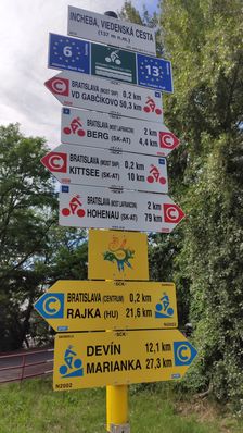
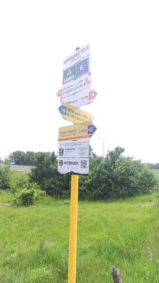
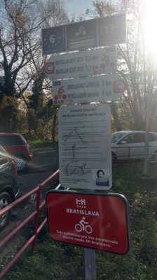
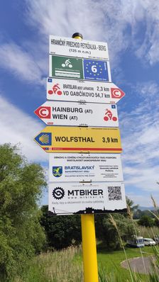
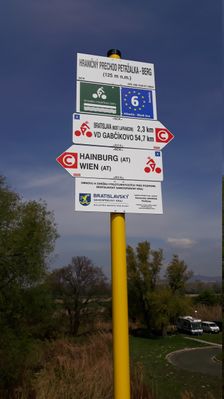
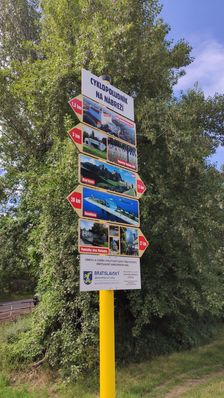
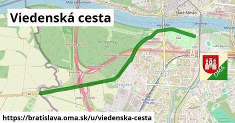
orientačná mapa ¤, Na Petržalskom grunte ¤, Most SNP ¤, Sad Janka Kráľa, Viedenská cesta ¤, Incheba, Viedenská cesta ¤, orientačný bod ¤, orientačná mapa ¤, Bratislava ¤, Dunaj a Petržalka ¤, Múzeum Petržalského opevnenia ¤, Bratislavské luhy ¤, číslo III/51 ¤, Hraničný priechod Petržalka - Berg ¤, Medzinárodná Dunajská cyklistická cesta ¤, Cyklotrasa Petržalské bunkre ¤, Múzeum petržalského opevnenia ¤, Stopy modernej Petržalky ¤, Kapitulské pole ¤, Vojny a mier v Petržalke ¤, Petržalčania ¤, Divadlo Aréna ¤, Petržalská vodná veža ¤, Sacravelo ¤, Petržalské mýto ¤, Vitajte v Sade Janka Kráľa ¤, Protinapoleónsky val / Vzácna pamiatka na boje v roku 1809 ¤šport
boules ¤, Slovenský veslársky klub ¤, Slovenský veslársky klub ¤, plážový volejbal ¤, detské ihrisko ¤, Detské ihrisko Tyršovo nábrežie ¤, detské ihrisko ¤, ihrisko ¤, skejtbord ¤, ihrisko ¤, basketbal ¤, basketbal ¤, BellyKick ¤, basketbal ¤, detské ihrisko ¤, tenis ¤, plážový volejbal ¤, plážový volejbal ¤Voľný čas
Escape Zone ¤, Rebuy Stars ¤, Aréna ¤, Tyršovo nábrežie ¤, park ¤, miesto na uviazanie psov ¤, miesto na uviazanie psov ¤, divadlo ¤, Galéria M++ ¤, miesto na uviazanie psov ¤, LOĎ - Divadlo v podpalubí ¤, Mýtny domček ¤, Apart ¤, Sad Janka Kráľa ¤Služby
kôš ¤, kôš ¤, Colný úrad Bratislava - Stanica colného úradu Bratislava - centrála ¤, Meditrade ¤, kôš ¤, kôš ¤, kôš ¤, kôš ¤, kôš ¤, kôš ¤, toaleta ¤, kôš ¤, toaleta ¤, toaleta ¤, kôš ¤, kôš ¤, kôš ¤, kôš ¤, kôš ¤, Heidelberg Slovensko ¤, kôš ¤, kôš ¤, kôš ¤, kôš ¤, kôš ¤, toaleta ¤, kôš ¤, kôš ¤, kôš ¤, toaleta ¤Doprava
heliport ¤, Kremnická ¤, Kremnická ¤, Sad Janka Kráľa ¤, automat na lístky ¤, automat na lístky ¤, Sad Janka Kráľa ¤Auto
Viedenská cesta ¤, parkovisko ¤, parkovisko ¤, parkovisko ¤, parkovisko ¤, parkovisko ¤, parkovisko ¤, parkovisko ¤, parkovisko ¤, parkovisko ¤, parkovisko ¤, parkovisko ¤, parkovisko ¤, parkovisko ¤, parkovisko ¤, parkovisko ¤, parkovisko ¤, parkovisko ¤, parkovisko ¤, parkovisko ¤, parkovisko ¤, parkovisko ¤, Q-service ¤, parkovisko ¤, parkovisko ¤, parkovisko ¤, parkovisko ¤, parkovisko ¤, parkovisko ¤, Slovnaft ¤Vzdelanie
Gašparko ¤, Bilingválne gymnázium ¤, Súkromná hotelová akadémia ¤, Súkromná obchodná akadémia ¤, Súkromné gymnázium ¤, Evanjelické lýceum, Vranovská 2 ¤Pamiatky
Viedenská električka ¤, číslo III/54 ¤, Míľnik Červenej armády ¤, Koncentračný tábor v Petržalke (Engerau) ¤, číslo III/51 ¤, číslo III/55 ¤, Pomník obetiam genocídy Arménov ¤, pamätník ¤, Nemecký veslársky klub ¤, socha ¤, UFO ¤, socha ¤, Erb Bratislavy ¤, číslo III/50 ¤, Erb Bratislavy ¤, Mierové zmluvy / Trianon ¤, číslo III/56 ¤, Škorpión ¤, socha ¤, Pontónový most cez Dunaj (1945) ¤, Mierové zmluvy ¤, socha ¤, Slovenský veslársky klub ¤, Kvet ¤, Nástupište propeleru ¤, Incheba tower ¤, Strelec ¤, Panna ¤, číslo III/49 ¤, Janko Kráľ ¤Bicykel
cyklostojan ¤, Viedenská - pod mostom SNP ¤, cyklostojan ¤, Slovnaft ¤, Cyklokuchyňa Bratislava ¤, cyklostojan ¤, cyklostojan ¤, miesto na uviazanie psov ¤, WhiteBikes ¤, cyklostojan ¤, cyklostojan ¤, miesto na uviazanie psov ¤, cyklostojan ¤, miesto na uviazanie psov ¤, Mýtny domček ¤, cyklostojan ¤Prístupnosť
toaleta ¤, Pontónový most cez Dunaj (1945) ¤, Z-Box ¤, Kvet ¤, Z-Box ¤, Základný kameň pamätníka slovenského vysťahovalectva a zahraničných Slovákov ¤, Bao brothers ¤, Sad Janka Kráľa ¤, pitná voda ¤, Sad Janka Kráľa ¤, toaleta ¤, pitná voda ¤, pitná voda ¤