Viac
Viac info:
aktualizovať mapu,
uprav v JOSM (pokročilé),
4248402,
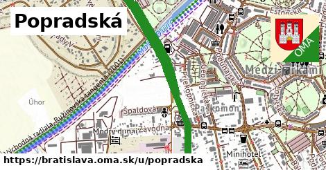
stiahni GPX, oblast id: 1702499, dlzka: 2488, oblast name: Bratislava, oblast asci: bratislava, psc: {82105, 82106}, obce:
Slovensko,
Podunajská nížina,
Podunajská rovina,
Bratislavský kraj,
Bratislava,
okres Bratislava II,
Podunajské Biskupice,
Ružinov,
Prievoz,
Medzi jarkami, lon: 17.19304743228178, lat: 48.138787497048256, lit: yes, foot: yes, lanes: 2, layer: 1, bridge: yes, oneway: yes, covered: yes, abutters: residential, maxspeed: 50, shoulder: no, sidewalk: no, maxheight: 4.6, maxweight: 21, placement: middle of:2, psv:lanes: yes|designated, oma:sekcia: presovsky kraj, smoothness: excellent, turn:lanes: through|through|through, osm version: 10, trolley wire: yes, lanes:forward: 1, maxspeed:type: SK:urban, osm changeset: 0, osm timestamp: 2021 11 14T12:51:19Z, sidewalk:left: no, vehicle:lanes: yes|no, lanes:backward: 2, sidewalk:right: separate, source:maxspeed: SK:urban, left of:1, none|right,