čísla
10 ¤, 10A ¤, 12 ¤, 12A ¤, 14 ¤, 14A ¤, 16 ¤, 18 ¤, 1A ¤, 26 ¤, 4 ¤, 5 ¤, 6 ¤, 6A ¤, 7 ¤, 2820 ¤Stravovanie
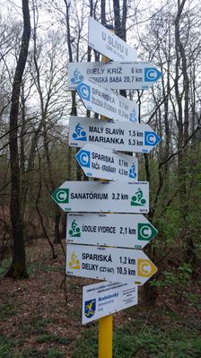
verejný gril ¤, prameň ¤, II. lom ¤, Studnička II. rybník ¤, Železná studnička ¤, Pod dubmi ¤, U Slivu ¤, prameň ¤, Klepáč ¤, verejný gril ¤, Františkov prameň ¤, prameň ¤, Mihály forrás ¤, Žufet ¤, verejný gril ¤, Bufet Železná studnička ¤, rýchle občerstvenie ¤, verejný gril ¤, bezbarierový prístup ¤, verejný gril ¤, Kávička u Janíčka ¤, Snežienka ¤, Johanka ¤Turistika
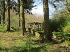
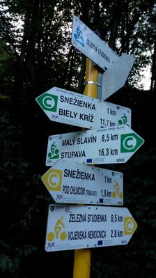
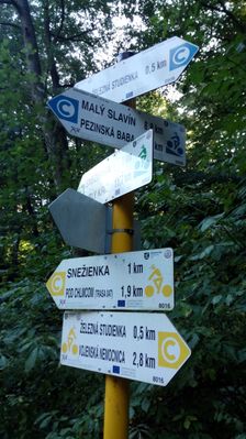
Bukva, Vydrické rybníky ¤, Druhý kameňolom ¤, orientačný bod ¤, Snežienka ¤, Deviaty Mlyn ¤, U Slivu ¤, Podzemné opevnenia Bratislavy z 1.svetovej vojny ¤, Železná studnička ¤, Územie európskeho významu Vydrica ¤, Drevo ako obnoviteľná surovina ¤, Mestské lesy v Bratislave ¤, Ekológia ¤, IX. mlyn - "Suchý mlyn" ¤, Mokrade ¤, verejný gril ¤, Druhy vtáčích búdok ¤, Železná studienka ¤, Novinky z lesa ¤, Sváko Ragan ¤, U Slivu ¤, Mestské lesy v Bratislave ¤, VIII. mlyn - "Klepáč" ¤, Mestské lesy v Bratislave ¤, História a súčasnosť ¤, prístrešok, altánok ¤, Železná studienka ¤, Rastliny I. ¤, Bratislava a Mestské lesy ¤, Malé Karpaty - Bratislava ¤, prístrešok, altánok ¤šport
stolný tenis ¤, detské ihrisko ¤, detské ihrisko ¤, Detské ihrisko pre veľké deti ¤, detské ihrisko ¤, Detské ihrisko pre malé deti ¤, detské ihrisko ¤, detské ihrisko ¤, Pri modrom domčeku ¤, stolný tenis ¤, stolný tenis ¤, boules ¤, boules ¤, basketbal ¤, futbal ¤Voľný čas
Partizánska lúka ¤, Amfiteáter Železná studnička ¤, Sochársky ateliér Franz Xaver Messerschmidt ¤Služby
kôš ¤, kôš ¤, kôš ¤, kôš ¤, kôš ¤, kôš ¤, kôš ¤, kôš ¤, kôš ¤, toaleta ¤, kôš ¤, kôš ¤, toaleta ¤, kôš ¤, toaleta ¤, kôš ¤, toaleta ¤, kôš ¤, kôš ¤, kôš ¤, kôš ¤Doprava
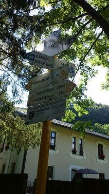
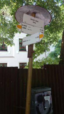
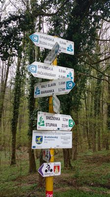
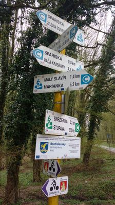
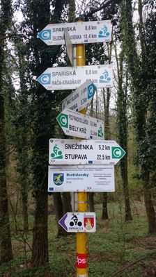
Klepáč ¤, Železná studnička ¤, Železná studnička ¤, Kameňolom ¤, Drieňovské lúky ¤, Deviaty mlyn ¤, Drieňovské lúky ¤, Lanovka ¤, Kameňolom ¤, Deviaty mlyn ¤, Klepáč ¤, Lanovka ¤, Lesopark ¤, Bukva ¤, Partizánska lúka ¤, Bukva ¤, Železná studnička ¤, Partizánska lúka ¤, Bratislava-Železná studienka ¤Auto
parkovisko ¤, nabíjacia stanica ¤, parkovisko ¤, parkovisko ¤, umývarňa bicyklov ¤, Železná Studnička ¤, ZSE Železná studnička ¤Príroda
prameň ¤, II. lom ¤, Studnička II. rybník ¤, Železná studnička ¤, Pod dubmi ¤, prameň ¤, výhľad ¤, Františkov prameň ¤, prameň ¤, Mihály forrás ¤, Snežienka ¤, Johanka ¤, výhľad ¤Pamiatky
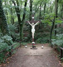
hraničný kameň ¤, Prvá manifestácia bratislavských robotníkov ¤, C/1 1 ¤, Hrdinom SNP ¤, hraničný kameň ¤, 27 ¤, 2 ¤, hraničný kameň ¤, sv. Ambróz ¤, Päste ¤, Kaplnka pokoja ¤, socha ¤, socha ¤, K-Klepáč ¤, socha ¤, 38 ¤, socha ¤, socha ¤, 3 ¤, 3 ¤, Vstupná plastika ¤, hraničný kameň ¤, 3/1 ¤, hraničný kameň ¤, 3/2 ¤, K-Klepáč 0 ¤, K-Lam 4 ¤Prístupnosť
Železná studnička ¤, Domček na strome Dlhé lúky ¤, bezbarierový prístup ¤, ZSE Železná studnička ¤, Bratislava-Železná studienka ¤